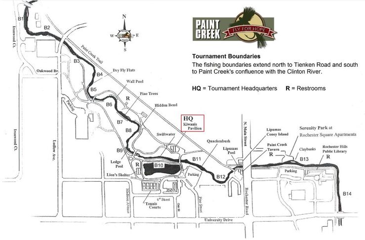
Boundaries and Beats
Below is an image of the official map for the trout tournament legal fishing boundaries. You can print this as a temporary reference. You will be supplied with a sharper copy at the event. Again for 2014 we are extending the tournament fishing boundaries north to Tienken Road and south to Paint Creek's confluence with the Clinton River.
For a fun Google Earth fly-over of the entire fishing range click on the color image to the right. You will need Google Earth installed on your device to view the fly-over. You can download Google Earth for free!